
( – promoted by buhdydharma )
 Point Fermin Light |
On July 6, the day before we were scheduled to travel to Vegas, we decided it would be a good day to indulge in our interest in lighthouses, so we planned a trip to San Pedro and Point Fermin Lighthouse.
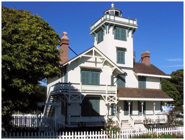
Look quickly because this image, downloaded from the Internet, is as close as we got. That’s really too bad, because it really is historic. Built in 1874, its 2100-candelpower light had a Fresnel lens that was brought around Cape Horn on sailing ships. The first keeper was Mary L. Smith, who lived with her sister. They gave up the occupation because of loneliness: the closest neighbors were in Wilmington, CA, 5 or 6 miles to the north.
Unfortunately, Google map directions let us down and instructed us to turn right at the wrong time, which resulted in us arriving at Point Vicente Lighthouse in Rancho Palos Verdes, past what is called Portuguese Bend, instead of finding Point Fermin. Part of this was bad: Point Vicente was not open on that day. Then again, it was hardly what one could call vertical, so climbing it might not have been all that good of an idea anyway.
 Point Vicente |
Point Vicente was named by Captain George Vancouver in 1790 in honor of his friend, Friar Vicente of Mission Buenaventura. Vancouver also named Point Fermin. Because the area was an extreme danger to ships in the area, the US Lighthouse Service began operating a beacon on May 1, 1926, using a lens which had already had 40 years of service in Alaska. The light was transferred to the Coast Guard in 1939 and was automated in 1971.
During WW II the 1000 wall light was replaced by a 25 watt light and blackout curtains stood at the ready.
The windows facing inland were painted white after the war due to complaints from residents and because it was a driving hazard. This led to reports of ghost sightings of “The Lady of the Light”.
 Interpretive Center |
On the plus side, the Palos Verdes Peninsula/Point Vicente Interpretive Center was open. I can only really speak for myself, but I believe we had a great time. Just northwest of land previously dedicated to Marineland of the Pacific. the views from Point Vicente were breathtaking. It just looked so beautiful from where we were and it allowed us to see the whole area from above. I thought it was so beautiful that I was even thinking about the possibility of moving here on a permanent basis, just so that I could see these sights all the time. My friend told me about these Rancho Palos Verdes houses for sale that he thinks we should look at, just in case this was something that we were really thinking about doing. Don’t get me wrong, I did have a little look at some of the properties, and they were just beautiful. But unfortunately, this isn’t something that we are currently thinking about, but it could be one day in the future. There were just so many things that caught my eye. The Interpretive Center has quite a tribute to Marineland, as well as information about whales and whaling, and the geology, flora, and fauna of the area.
The land on which the center sits, we were told, had at one time been one of the Channel Islands, but had collided with the mainland. Since that time, parts of the land had been slowly slipping away towards and even into Abalone Cove, down below the cliffs.
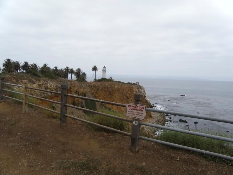
 Nonvertical Lighthouse |
The peninsula is a techtonic fault block of seafloor that was pushed up by a mountain of metamorphic rocks starting about 1.5 million years ago. The Palos Verdes Fault is to the north and the peninsula is being deformed by movement along that fault. That can be seen in the fact that the Lighthouse is no longer vertical.
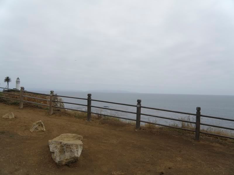
In fact, the entire area is arching upward, causing some of the parts closer to the ocean to tilt in that direction. On the way there, we saw water lines laid along the road rather than buried…with signs warning travelers of danger in the area.
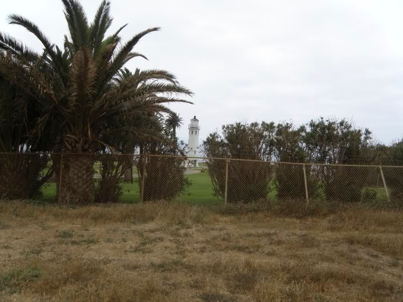
 From the Entrance |
When we drove up to the gates, we discovered it was closed…and only open a couple of days per month. I took my first shot through the gate, but you could almost not see the light from there, since it was hidden behind some palm trees.
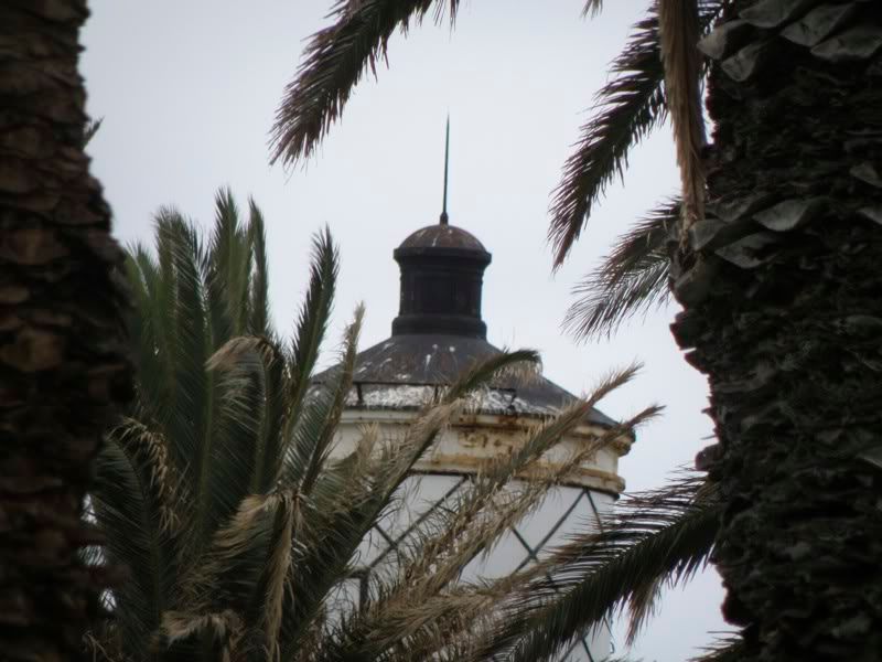 Glimpse |
But I managed to spot it and zoomed in for a closer look of the top, before we discovered that we could see it better from the grounds to the north…which were apparently used from time to time as a parking lot.
 Side View |
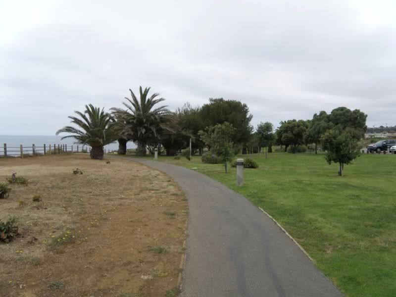
Being somewhat obsessive about getting the right view, I moved over in that direction and noticed a paved walkway which went through what seemed to be a park and picnic area.
 Zoom |
Having seen upon driving in that there was supposed to be an Interpretive Center as well as the lighthouse, we decided to follow the path.
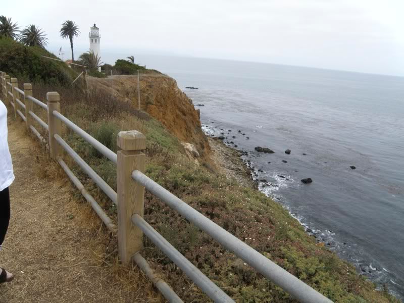
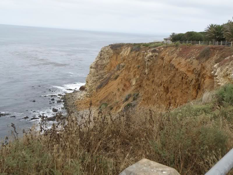 Dangerous Cliffs |
Along the way we were warned of danger very close to our left and to watch for the occasional rattlesnake.
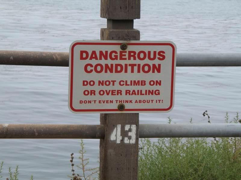 Don’t Even Think about It! |
Eventually we encountered a clump of vegetation. The center was on the other side.
 Behind those trees |
We actually entered the center through its back door, but that’s okay since there is no charge…although they do take donations, which we were happy to give.
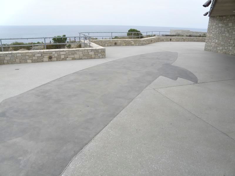
On the terrace outside was a whale-sized whale mosaic. I was the first thing we saw…besides the building itself.
Inside we were told that in the right seasons, whales are sometimes spotted from the terrace, especially the Pacific Gray whale migration from December through March, and blue, humpback, and minke whales at other times of the year. Dolphins and sea lions can also be spotted.
 Whale Mosaic |
Inside, the main lobby had some dioramas of the native biology. My camera did not pick up much from the tidepool diorama or the kelp bed diorama because of glass and lighting issues, but I did catch the land and air exhibit, with the California state bird (the quail) and a raccoon…being swooped down upon by an owl.
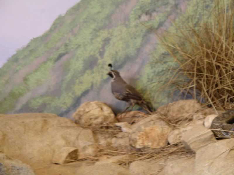 Center Diorama: Quail |
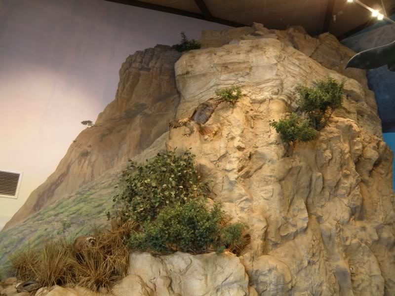 Center Diorama: Owl and Raccoon |
Besides the owl, there was the model of a small whale hanging from the ceiling. The lobby also contained the gift shop, from which we managed to purchase some items.
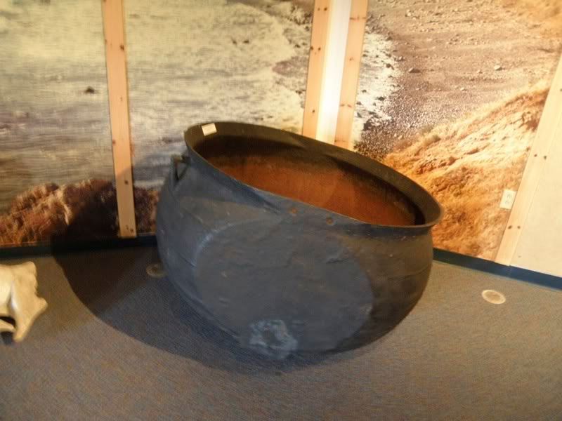 Pot for cooking whale blubber |
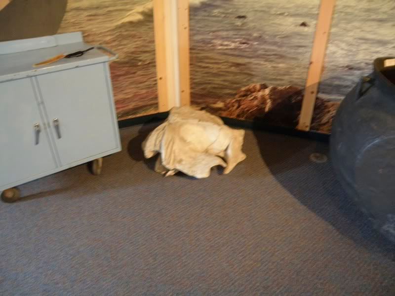 Whale Skull |
I did not take any photos of the Marineland of the Pacific exhibits, since they were mostly photos and/or advertisements themselves, but the place did have some good information on whales and the evils of whaling.
Before we departed the area, I took a shot towards Catalina Island, in the hope that my camera would be able to pick up what was difficult to see with the naked eye because of the haze.
 Catalina in the Distance |
And one more pic of the light:
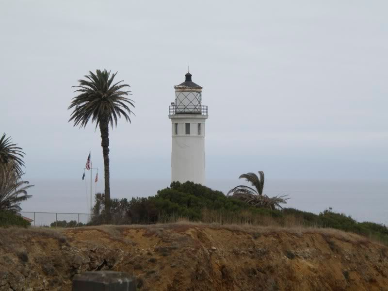 Point Vicente Light |
2 comments
Author
The Vasquez Rocks piece comes after this one.
and if it’s any consolation, the lighthouse was closed when I visited as well, however, I thought the exterior and surroundings were still worth seeing.
Hope you also had the opportunity to see the Korean Bell of Friendship and Bell Pavilion in Angels Gate Park, located high on a hill overlooking the Point Vicente lighthouse.
Another fascinating nearby attraction is the Wayfarer’s Chapel in Rancho Palos Verdes, which was designed by Lloyd Wright (Frank Lloyd Wright’s son), which was constructed between 1949 and 1951. The chapel is listed on the National Register of Historic Places and is conmonly referred to as “The Glass Church.”